Screenshot of Transitland
Yesterday, I arrived in Newport, RI for a wedding this weekend. I was planning on flying into Providence, RI and then taking a ferry from Providence to Newport. Easy peasy. Unfortunately, my flight from Chicago to Providence was cancelled at the last minute, and I was rebooked on a flight to Boston. That’s close, but not close enough. I ended up staying the night in Boston, and then I took a half hour Amtrak from Boston to Providence to catch my already-booked ferry. In the grand scheme of things, it wasn’t terrible, and I was still able to get here without a car (though I Uber-ed a couple times). It’s times like these that Transitland could actually come in handy. It’s an interesting interactive map that lets you explore all the public transportation routes all across the world. It’s not really a route-planning tool, because Google Maps already does that pretty well. But, it’s a fun exercise of seeing your options.
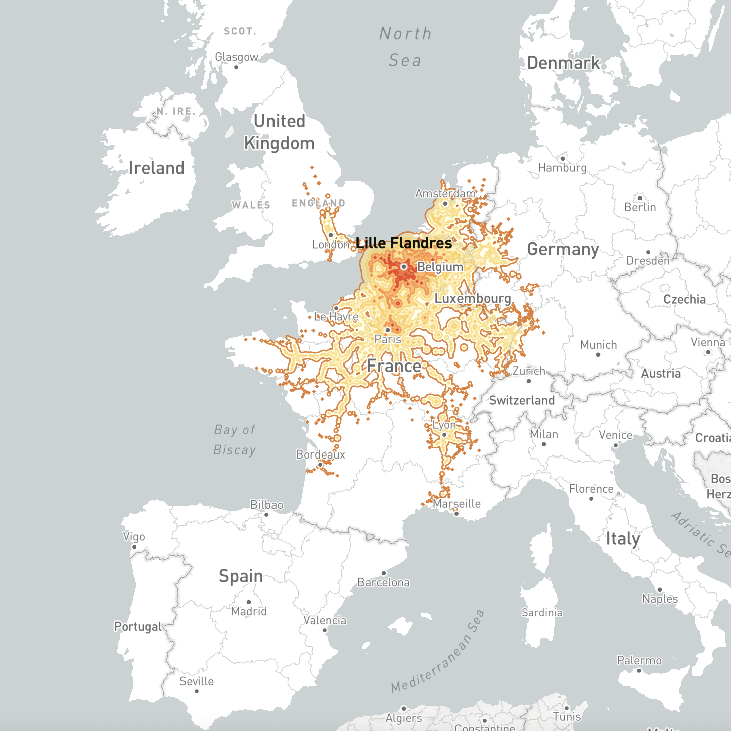
Screenshot of Europe 5 Hour Train
This trip also got me thinking about a post from Brandon Donnelly’s daily blog a few weeks ago. He linked this different interactive map that allows you to see how far you can go in Europe within a 5 hour train ride. It’s also not a route-planning tool or anything, but it’s fun and truly visualizes the connectivity of Europe. As an American, I am jealous. I love trains, and I wish I didn’t have to fly as much to get around. For most of the country, we lack that robust infrastructure and train system. But, there is a region where trains actually work. And that’s where I am this weekend. Amtrak states that the Northeast Corridor (NEC) is “the nation’s most congested rail corridor and is one of the highest volume rail corridors in the world.”
Yay for Amtrak and their high speed trains. It’s exciting, but it’s also one of the densest parts of the US. So, it’s not that crazy to see why Amtrak has such a presence here. Since non-Northeast US isn’t nearly as dense as Europe, we definitely need to build out our high speed rail networks (lets go Hyperloop!). But, that’s a topic for an entirely different post. I urge you to play around with the interactive maps. Sometimes things don’t need to actually have much purpose, other than to have a little fun and expose you to new perspectives and/or ideas.


